About Tai Mo Shan
Although Hong Kong is in the tropics, frost and icicles occasionally appear on the upper slopes of Tai Mo Shan, the city’s highest peak and an extinct volcano. This mighty mountain at the heart of the New Territories surpasses all other peaks in the city for its altitude and magnitude, and it’s noticeably cooler up there. Sometimes you’ll find yourself briefly surrounded by quick-moving clouds, or even see them filling valleys far below. Follow this trail for some of the most striking views Hong Kong has to offer. It is also one of the best places to catch the sunrise in Hong Kong.
Refuel
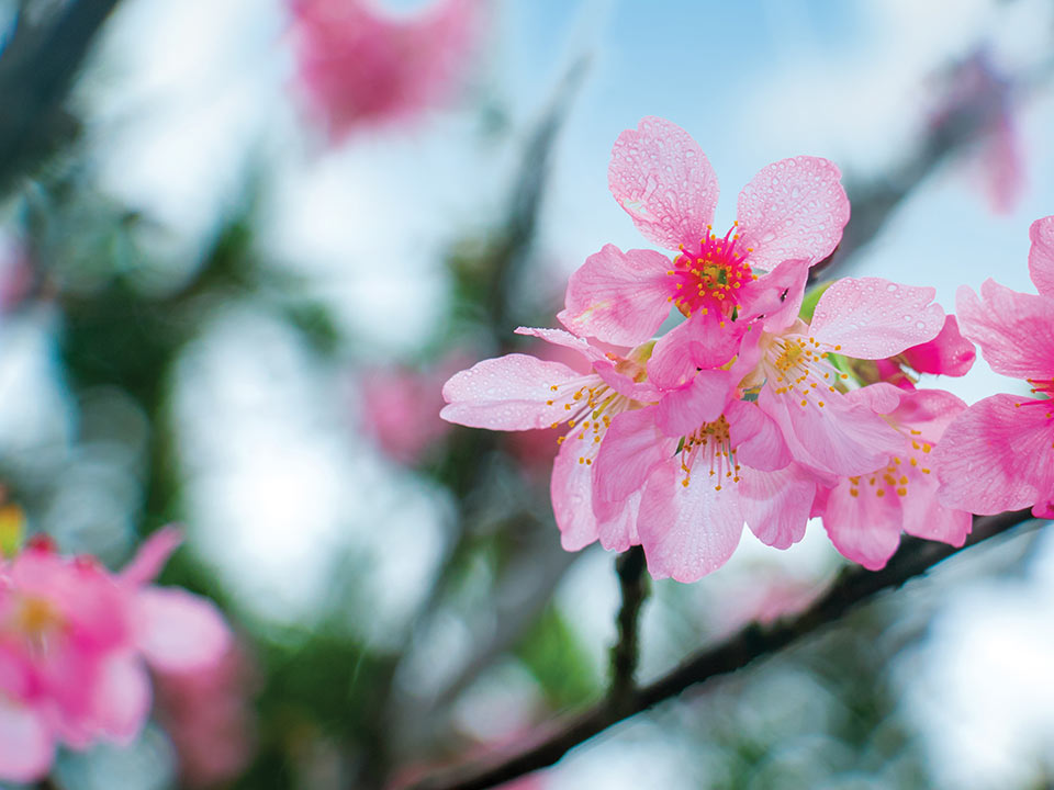
Head up the steps from the car park and you’ll find a sundial set in the centre of a garden. In springtime, you can take Instagram-worthy photos of colourful blossoms on the Taiwan cherry trees here. Walk across to the Rotary Park viewing point, from which, through a parting in the forest, you can see the Victoria Harbour and even as far as Hong Kong Island. If you venture a few minutes down the trails from here, you’ll reach beautifully decorated Chinese-style pavilions shaded by leafy boughs.
Return to Tai Mo Shan Road, a little further up the hill stands the Tai Mo Shan Country Park Visitor Centre. Take some time to view the exhibitions of local wildlife, weather trends and environmental issues, as it will enhance your understanding of the places you are about to see.
You can now leave the road behind, and start hiking on MacLehose Trail Section 8. It leads up from the Visitor Centre, hugging the hillside until it brings you to the Tai Mo Shan Lookout — an exposed, windy spot with stunning panoramic views. When the weather is favourable, you have a dramatic view out across the Yuen Long plain — and the sunrise here is incomparable. At other times, the altitude can cause the Lookout to be enveloped in clouds; but they may disperse as quickly as they descended.
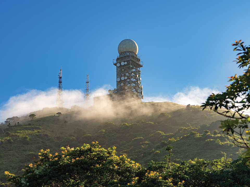
Instead of trees, tall silvergrass grows on the upper slopes of Tai Mo Shan. The grass blades wave gently in the breeze and catch the sunlight as you hike higher up the mountain. When you see the huge golf-ball dome of the Hong Kong Observatory’s weather radar station, you know you are approaching the 957 m summit — another great photo spot. From this airy vantage point you’re treated to expansive views of mountain ridges extending in all directions, as well as the urban areas and sea channels. On a clear day, almost the entirety of Hong Kong — mountains, city, islands and harbour — can be seen in one sweeping 360-degree panorama.
From Rotary Park, a trail leads downhill for half an hour through pretty woodland to Chuen Lung village. This long-established settlement is known for the watercress which is grown here in fields fed by mountain streams. The village has old-fashioned tea houses serving dim sum during the day — think har gau (shrimp dumpling), siu mai (pork dumpling), char siu bao (honey-glazed roast pork bun) and other traditional favourites.

Head up the steps from the car park and you’ll find a sundial set in the centre of a garden. In springtime, you can take Instagram-worthy photos of colourful blossoms on the Taiwan cherry trees here. Walk across to the Rotary Park viewing point, from which, through a parting in the forest, you can see the Victoria Harbour and even as far as Hong Kong Island. If you venture a few minutes down the trails from here, you’ll reach beautifully decorated Chinese-style pavilions shaded by leafy boughs.

Return to Tai Mo Shan Road, a little further up the hill stands the Tai Mo Shan Country Park Visitor Centre. Take some time to view the exhibitions of local wildlife, weather trends and environmental issues, as it will enhance your understanding of the places you are about to see.

You can now leave the road behind, and start hiking on MacLehose Trail Section 8. It leads up from the Visitor Centre, hugging the hillside until it brings you to the Tai Mo Shan Lookout — an exposed, windy spot with stunning panoramic views. When the weather is favourable, you have a dramatic view out across the Yuen Long plain — and the sunrise here is incomparable. At other times, the altitude can cause the Lookout to be enveloped in clouds; but they may disperse as quickly as they descended.

Instead of trees, tall silvergrass grows on the upper slopes of Tai Mo Shan. The grass blades wave gently in the breeze and catch the sunlight as you hike higher up the mountain. When you see the huge golf-ball dome of the Hong Kong Observatory’s weather radar station, you know you are approaching the 957 m summit — another great photo spot. From this airy vantage point you’re treated to expansive views of mountain ridges extending in all directions, as well as the urban areas and sea channels. On a clear day, almost the entirety of Hong Kong — mountains, city, islands and harbour — can be seen in one sweeping 360-degree panorama.

From Rotary Park, a trail leads downhill for half an hour through pretty woodland to Chuen Lung village. This long-established settlement is known for the watercress which is grown here in fields fed by mountain streams. The village has old-fashioned tea houses serving dim sum during the day — think har gau (shrimp dumpling), siu mai (pork dumpling), char siu bao (honey-glazed roast pork bun) and other traditional favourites.


